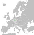
Файл:Landgraviate of Hesse-Kassel 1789.svg

Сығанаҡ файл (SVG файлы, кәмендә 450 × 456 нөктә, файлдың дәүмәле: 928 КБ)
Был файл һаҡлау урыны Викиһаҡлағыста һаҡлана. Уның тураһында мәғлүмәттәр түбәндә күрһәтелгән.
Викиһаҡлағыс — Викимедиа проекттарында ҡулланылған ирекле файлдар өсөн үҙәкләштерелгән һаҡлағыс. |
Ҡыҫҡа аңлатма
Лицензиялау
- Һеҙгә мөмкин:
- бүлешергә – эште күсереп алырға, таратырға һәм тапшырырға
- үҙгәртергә – эште яраҡлаштырырға
- Түбәндәге шарттарҙа:
- авторлыҡты асыҡлау – Авторлыҡты, лицензияға һылтанманы һәм авторҙың ниндәй ҙә булһа үҙгәрештәр индергәнме-юҡмы икәнлеген күрһәтергә тейешһегеҙ. Быны теләһә ниндәй ысул менән эшләргә мөмкин, әммә лицензиат һеҙгә ярҙам иткән йәки ошо әҫәрҙе ҡулланыуығыҙҙы хуплаған тигән тойғо тыуырға тейеш түгел.
- шул уҡ шарттарҙа – Әгәр һеҙ был әҫәрҙе үҙгәртәһегеҙ, уның нигеҙендә яңы әҫәр яҙаһығыҙ икән, сығанаҡ әҫәр рөхсәтнамәһен йәки шуға тура килә торған лицензия ҡулланырға тейешһегеҙ.
Төп йөкләүҙәр журналы
This image is a derivative work of the following images:
- File:Europe_1789.svg licensed with Cc-by-sa-3.0
- 2013-04-14T03:44:26Z Alphathon 450x456 (858577 Bytes) Corrected some errors in northern Italy
- 2013-04-14T01:38:01Z Alphathon 450x456 (853881 Bytes) tweaked again
- 2013-04-14T01:36:10Z Alphathon 450x456 (853881 Bytes) Tweaked Holy Roman Empire border style
- 2013-04-14T01:33:26Z Alphathon 450x456 (853857 Bytes) == {{int:filedesc}} == {{Information |Description={{en|A blank Map of Europe circa 1789. This map also includes a border for the [[:en:Holy Roman Empire|Holy Roman Empire]]. Since there are so many small German states, they h
Uploaded with derivativeFX
Краткие подписи
Элементы, изображённые на этом файле
һүрәтләнгән объект
14 апрель 2013
Файл тарихы
Файлдың күрһәтелгән ваҡытта ниндәй өлгөлә булғанын ҡарар өсөн баҫығыҙ: Дата/ваҡыт
| Дата/ваҡыт | Миниатюра | Үлсәмдәре | Ҡатнашыусы | Иҫкәрмә | |
|---|---|---|---|---|---|
| ағымдағы | 07:53, 17 октябрь 2021 |  | 450 × 456 (928 КБ) | Fenn-O-maniC | Fixed the Russo-Swedish border to match the Treaty of Åbo of 1743 |
| 20:17, 18 апрель 2013 |  | 450 × 456 (948 КБ) | Alphathon | Various fixes and style change | |
| 17:58, 14 апрель 2013 |  | 450 × 456 (831 КБ) | Alphathon | == {{int:filedesc}} == {{Information |Description={{en|A map of the Landgraviate of Hesse-Kassel circa 1789.}}{{de|Eine Landkarte die Landgrafschaft Hessen-Kassel c. 1789.}} |Sou... |
Файл ҡулланыу
Был файлды ҡулланған биттәр юҡ.
Файлды глобаль ҡулланыу
Был файл түбәндәге википроекттарҙа ҡулланыла:
- da.wikipedia.org проектында ҡулланыу
Метамәғлүмәттәр
Файл һанлы камералар йәки сканерҙар өҫтәгән мәғлүмәттәргә эйә. Әгәр файл яһалғандан һуң төҙәтелгән булһа, ҡайһы бер параметрҙар ағымдағы рәсем менән тап килмәҫкә мөмкин.
| Ҡыҫҡа исем | A map of Hesse-Kassel within the Holy Roman Empire and Europe ca. 1789 |
|---|---|
| Рәсемдең исеме | A map of the Landgraviate of Hesse-Kassel within the Holy Roman Empire, and within Europe, circa 1789. This map is licensed under the Creative Commons Attribution-Share Alike 3.0 Unported license (https://creativecommons.org/licenses/by-sa/3.0/) by the wikimedia user "Alphathon" (http://commons.wikimedia.org/wiki/User:Alphathon), and is based upon "Blank map of Europe.svg" (http://commons.wikimedia.org/wiki/File:Blank_map_of_Europe.svg), the details of which follow:
A blank Map of Europe. Every country has an id which is its ISO-3166-1-ALPHA2 code in lower case. Members of the EU have a class="eu", countries in europe (which I found turkey to be but russia not) have a class="europe". Certain countries are further subdivided the United Kingdom has gb-gbn for Great Britain and gb-nir for Northern Ireland. Russia is divided into ru-kgd for the Kaliningrad Oblast and ru-main for the Main body of Russia. There is the additional grouping #xb for the "British Islands" (the UK with its Crown Dependencies - Jersey, Guernsey and the Isle of Man) Contributors. Original Image: (http://commons.wikimedia.org/wiki/Image:Europe_countries.svg) Júlio Reis (http://commons.wikimedia.org/wiki/User:Tintazul). Recolouring and tagging with country codes: Marian "maix" Sigler (http://commons.wikimedia.org/wiki/User:Maix) Improved geographical features: http://commons.wikimedia.org/wiki/User:W!B: Updated to reflect dissolution of Serbia & Montenegro: http://commons.wikimedia.org/wiki/User:Zirland Updated to include British Crown Dependencies as seperate entities and regroup them as "British Islands", with some simplifications to the XML and CSS: James Hardy (http://commons.wikimedia.org/wiki/User:MrWeeble) Validated (http://commons.wikimedia.org/wiki/User:CarolSpears) Changed the country code of Serbia to RS per http://en.wikipedia.org/wiki/Serbian_country_codes and the file http://www.iso.org/iso/iso3166_en_code_lists.txt (http://commons.wikimedia.org/wiki/User:TimothyBourke) Uploaded on behalf of User:Checkit, direct complaints to him plox: 'Moved countries out of the "outlines" group, removed "outlines" style class, remove separate style information for Russia' (http://commons.wikimedia.org/wiki/User:Collard) Updated various coastlines and boarders and added various islands not previously shown (details follow). Added Kosovo and Northern Cyprus as disputed territories. Moved major lakes to their own object and added more. List of updated boarders/coastlines: British Isles (+ added Isle of Wight, Skye, various smaller islands), the Netherlands, Germany, Czech Republic, Denmark, Sweden, Finland, Poland, Kaliningrad Oblast of the Russian Federation (and minor tweaks to Lithuania), Ukraine, Moldova (minor), Romania, Bulgaria, Turkey, Greece, F.Y.R. Macedonia, Serbia, Bosnia and Herzegovina, Montenegro, Albania, Croatia, Italy (mainland and Sicily), Malta (http://commons.wikimedia.org/wiki/User:Alphathon). Added Bornholm (http://commons.wikimedia.org/wiki/User:Heb) Released under CreativeCommons Attribution ShareAlike (http://creativecommons.org/licenses/by-sa/2.5/). |
| Киңлек | 450 |
| Бейеклек | 456 |


