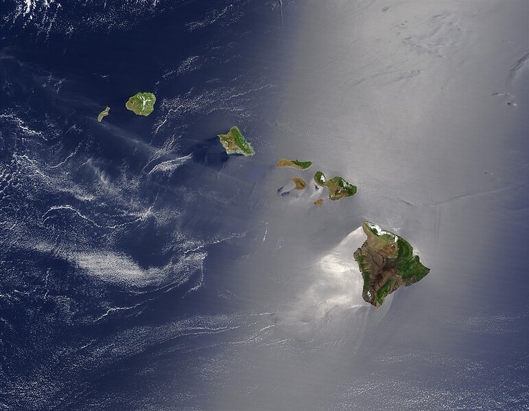
Файл:Hawaje.jpg

Ҡарап сығыу ваҡытындағы күләм: 771 × 600 пиксель. Башҡа айырыусанлыҡтар: 309 × 240 пиксель | 617 × 480 пиксель | 988 × 768 пиксель | 1280 × 996 пиксель | 2560 × 1991 пиксель | 3600 × 2800 пиксель.
Сығанаҡ файл ((3600 × 2800 пиксель, файл күләме: 1,16 Мб, MIME-төр: image/jpeg))
Файл тарихы
Файлдың күрһәтелгән ваҡытта ниндәй өлгөлә булғанын ҡарар өсөн баҫығыҙ: Дата/ваҡыт
| Дата/ваҡыт | Миниатюра | Үлсәмдәре | Ҡатнашыусы | Иҫкәрмә | |
|---|---|---|---|---|---|
| ағымдағы | 18:19, 26 октябрь 2005 |  | 3600 × 2800 (1,16 Мб) | Palladinus | Hawaii Islands |
Файл ҡулланыу
Был файлды ҡулланған биттәр юҡ.
Файлды глобаль ҡулланыу
Был файл түбәндәге википроекттарҙа ҡулланыла:
- arz.wikipedia.org проектында ҡулланыу
- bg.wikipedia.org проектында ҡулланыу
- ceb.wikipedia.org проектында ҡулланыу
- co.wikipedia.org проектында ҡулланыу
- en.wikipedia.org проектында ҡулланыу
- es.wikipedia.org проектында ҡулланыу
- fr.wikipedia.org проектында ҡулланыу
- fr.wiktionary.org проектында ҡулланыу
- gcr.wikipedia.org проектында ҡулланыу
- gl.wikipedia.org проектында ҡулланыу
- hr.wikipedia.org проектында ҡулланыу
- ky.wikipedia.org проектында ҡулланыу
- lv.wikipedia.org проектында ҡулланыу
- no.wikipedia.org проектында ҡулланыу
- oc.wikipedia.org проектында ҡулланыу
- pdc.wikipedia.org проектында ҡулланыу
- pl.wikipedia.org проектында ҡулланыу
- pl.wiktionary.org проектында ҡулланыу
- ro.wikipedia.org проектында ҡулланыу
- ru.wikipedia.org проектында ҡулланыу
- ru.wikinews.org проектында ҡулланыу
- sq.wikipedia.org проектында ҡулланыу
- sw.wikipedia.org проектында ҡулланыу
- to.wikipedia.org проектында ҡулланыу
- uk.wikipedia.org проектында ҡулланыу


