Файл:Denmark South Denmark location map.svg

SVG сығанаҡ файлы өсөн PNG ҡарап сығыу ваҡытындағы күләме: 783 × 600 пиксель. Башҡа айырыусанлыҡтар: 313 × 240 пиксель | 627 × 480 пиксель | 1003 × 768 пиксель | 1280 × 980 пиксель | 2560 × 1961 пиксель | 1000 × 766 пиксель.
Сығанаҡ файл (SVG файлы, кәмендә 1000 × 766 нөктә, файлдың дәүмәле: 252 Кб)
Был файл һаҡлау урыны Викиһаҡлағыста һаҡлана. Уның тураһында мәғлүмәттәр түбәндә күрһәтелгән.
Викиһаҡлағыс — Викимедиа проекттарында ҡулланылған ирекле файлдар өсөн үҙәкләштерелгән һаҡлағыс. |
Ҡыҫҡа аңлатма
| Тасуирлау |
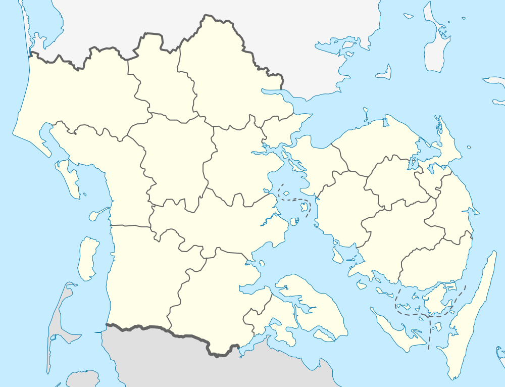
English: Location map of Region South Denmark in Denmark
Equirectangular projection, N/S stretching 177 %. Geographic limits of the map:
Deutsch: Positionskarte von der Region Syddanmark in Dänemark
Quadratische Plattkarte, N-S-Streckung 177 %. Geographische Begrenzung der Karte:
|
| Көнө | |
| Сығанаҡ | Шәхси эш |
| Автор | Erik Frohne |
| SVG‑разработка |
Лицензиялау
Мин, был эшкә авторлыҡ хоҡуҡтары эйәһе, үҙ теләгем менән уны түбәндәге лицензиялар шарттарына ярашлы баҫтырып сығарам:

|
Был документты Ирекле программа тәьминәте фонды тарафынан баҫтырылған GNU Free Documentation License рөхсәтнамәһенең 1.2 йәки һуңғыраҡ өлгөһө шарттарына ярашлы даими бүлектәрһеҙ, тәүге һәм аҙаҡҡы тышлыҡтарға урынлаштырыла торған текстарһыҙ күсереп алыу, таратыу һәм/йәки үҙгәртеү рөхсәт ителә. Рөхсәтнамәнең күсермәһен GNU Free Documentation License бүлегендә ҡарағыҙ. |
Был файл Creative Commons Attribution-Share Alike 3.0 Unported лицензияһы буйынса рөсхәт ителә.
- Һеҙгә мөмкин:
- бүлешергә – эште күсереп алырға, таратырға һәм тапшырырға
- үҙгәртергә – эште яраҡлаштырырға
- Түбәндәге шарттарҙа:
- авторлыҡты асыҡлау – Авторлыҡты, лицензияға һылтанманы һәм авторҙың ниндәй ҙә булһа үҙгәрештәр индергәнме-юҡмы икәнлеген күрһәтергә тейешһегеҙ. Быны теләһә ниндәй ысул менән эшләргә мөмкин, әммә лицензиат һеҙгә ярҙам иткән йәки ошо әҫәрҙе ҡулланыуығыҙҙы хуплаған тигән тойғо тыуырға тейеш түгел.
- шул уҡ шарттарҙа – Әгәр һеҙ был әҫәрҙе үҙгәртәһегеҙ, уның нигеҙендә яңы әҫәр яҙаһығыҙ икән, сығанаҡ әҫәр рөхсәтнамәһен йәки шуға тура килә торған лицензия ҡулланырға тейешһегеҙ.
Һеҙ лицензияның үҙегеҙ теләгәнен һайлай алаһығыҙ.
Файл тарихы
Файлдың күрһәтелгән ваҡытта ниндәй өлгөлә булғанын ҡарар өсөн баҫығыҙ: Дата/ваҡыт
| Дата/ваҡыт | Миниатюра | Үлсәмдәре | Ҡатнашыусы | Иҫкәрмә | |
|---|---|---|---|---|---|
| ағымдағы | 13:28, 13 ғинуар 2010 | | 1000 × 766 (252 Кб) | Erik Frohne | Reverted to version as of 18:51, 10 March 2009:Colors as agreed upon by german and french map makers. Use file Denmark South Denmark location map (da).svg instead if you need other colors |
| 01:36, 29 декабрь 2009 |  | 783 × 600 (1,35 Мб) | Hubertus45 | Changing colour after consensus with other users. | |
| 23:44, 14 декабрь 2009 |  | 783 × 600 (1,35 Мб) | Hubertus45 | Making the region more visible to the neighbour areas. | |
| 23:38, 14 декабрь 2009 |  | 783 × 600 (1,35 Мб) | Hubertus45 | Making the region more visible to the neighbour areas. | |
| 18:51, 10 март 2009 |  | 1000 × 766 (252 Кб) | Erik Frohne | {{Information |Description={{en|1=Location map of Region South Denmark in Denmark Equirectangular projection, N/S stretching 177 %. Geographic limits of the map: * N: 56.00° N * S: 54.70° N * W: 8.00° E * E: 11.00° E}} {{de|1=Positionskarte von der |
Файл ҡулланыу
Был файлды киләһе бит ҡуллана:
Файлды глобаль ҡулланыу
Был файл түбәндәге википроекттарҙа ҡулланыла:
- ce.wikipedia.org проектында ҡулланыу
- de.wikipedia.org проектында ҡулланыу
- Skallingen
- Årø
- Avernakø
- Bågø
- Drejø
- Hjortø
- Lyø
- Koresand
- Jordsand
- Tornø
- Barsø
- Knivsberg
- Ny Lillebæltsbro
- Lillebæltsbroen
- Langelandsbroen
- Horne Land
- Helnæs
- Tåsinge
- Augustenborg Kommune
- Gram Kommune
- Als Sund
- Æbelø
- Schloss Sonderburg
- Sundeved
- Siø
- Rømø Havn
- Slivsø
- Birkholm (Insel)
- Wikipedia:Kartenwerkstatt/Positionskarten/Europa
- Sylt-Rømø-Wattenmeerbucht
- Blue Water Arena
- Dejrø
- Vorlage:Positionskarte Dänemark Syddanmark
- Haderslebener Damm
- Bjørnø
- Fænø
- Snævringen
- Skarø
- Strynø
- Egholm (Bågø)
- Brandsø
- Thurø
- Kalvø
- Romsø
- Ejlinge
- Halmø
Был файлды глобаль ҡулланыуҙы ҡарарға.