Сығанаҡ файл(SVG файлы, кәмендә 886 × 1369 нөктә, файлдың дәүмәле: 703 Кб)

Ҡыҫҡа аңлатма

Тасуирлау
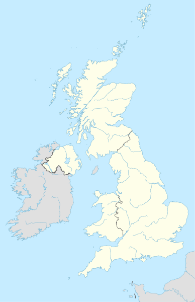
Deutsch: Positionskarte des Vereinigten Königreichs
English: Location map of the United Kingdom

Equirectangular projection, vertical stretching 170 %
Border coordinates

61.0
-11.0←↕→2.2
49.0
 Для справки This map is part of a series of location maps with unified standards: SVG as file format, standardised colours and name scheme. The boundaries on these maps always show the de facto situation and do not imply any endorsement or acceptance. In case of changes of the shown area the file is updated. The old version will be uploaded as a new file and thus is still available.
Көнө
Сығанаҡ

Собственная работа, используя:

  • United States National Imagery and Mapping Agency data

a. this product was developed using materials from the United States National Imagery and Mapping Agency and are reproduced with permission. b. this product has neither been endorsed nor authorized by the United States National Imagery and Mapping Agency or the United States Department of Defense.

  • World Data Base II data (public domain)
Автор NordNordWest
Kartenwerkstatt
Эта карта была улучшена в немецкой Kartenwerkstatt. Вы можете также предложить другие карты для улучшения.

Лицензиялау

Usage of this file with:

explanatory notes: Legally binding is only the full legalcode. For a free usage I recommend to respect the following licence conditions:
1. Provide my name as given above: NordNordWest,
2. a copy of, or the URI for, the applicable license: https://creativecommons.org/licenses/by-sa/3.0/de/legalcode,
3. the title of the work,
4. in the case of an adaptation, a credit identifying the use of the work in the adaptation.
This license and the rights granted hereunder will terminate automatically upon any breach by you of the terms of this license. Any of the above conditions can be waived if you get permission from the copyright holder. If you have questions or wish differing conditions, please contact me through nnwest@t-online.de or my discussion page

w:ru:Creative Commons
авторлыҡты асыҡлау шул уҡ шарттарҙа
Был файл Creative Commons Авторлыҡ күренеүе-Шул уҡ шарттар менән 3.0 Германия рөхсәтнамәһе шарттарында рөсхәт ителә.
Авторлыҡты асыҡлау: Karte: NordNordWest, Lizenz: Creative Commons by-sa-3.0 de
Һеҙгә мөмкин:
  • бүлешергә – эште күсереп алырға, таратырға һәм тапшырырға
  • үҙгәртергә – эште яраҡлаштырырға
Түбәндәге шарттарҙа:
  • авторлыҡты асыҡлау – Авторлыҡты, лицензияға һылтанманы һәм авторҙың ниндәй ҙә булһа үҙгәрештәр индергәнме-юҡмы икәнлеген күрһәтергә тейешһегеҙ. Быны теләһә ниндәй ысул менән эшләргә мөмкин, әммә лицензиат һеҙгә ярҙам иткән йәки ошо әҫәрҙе ҡулланыуығыҙҙы хуплаған тигән тойғо тыуырға тейеш түгел.
  • шул уҡ шарттарҙа – Әгәр һеҙ был әҫәрҙе үҙгәртәһегеҙ, уның нигеҙендә яңы әҫәр яҙаһығыҙ икән, сығанаҡ әҫәр рөхсәтнамәһен йәки шуға тура килә торған лицензия ҡулланырға тейешһегеҙ.

Краткие подписи

Добавьте однострочное описание того, что собой представляет этот файл
Местоположение на карте Соединенного Королевства

Элементы, изображённые на этом файле

һүрәтләнгән объект

Bredon английский

28 апрель 2015

MIME-тип русский

image/svg+xml

Файл тарихы

Файлдың күрһәтелгән ваҡытта ниндәй өлгөлә булғанын ҡарар өсөн баҫығыҙ: Дата/ваҡыт

Дата/ваҡытМиниатюраҮлсәмдәреҠатнашыусыИҫкәрмә
ағымдағы20:13, 28 апрель 201520:13, 28 апрель 2015 өлгөһө өсөн миниатюра886 × 1369 (703 Кб)NordNordWest== {{int:filedesc}} == {{Information |Description= {{de|1=Positionskarte des Vereinigten Königreichs}} {{en|1=Location map of the United Kingdom}} {{Location map series N |stretching=170 |top=61.0 |bottom=49.0 |left=-11.0 |right=2.2 }} |Source={{Own u...

Был файлды киләһе 4 биттәр ҡуллана:

Файлды глобаль ҡулланыу

Метамәғлүмәттәр