Файл:India Madhya Pradesh locator map.svg

Сығанаҡ файл (SVG файлы, кәмендә 1574 × 1738 нөктә, файлдың дәүмәле: 836 Кб)
Был файл һаҡлау урыны Викиһаҡлағыста һаҡлана. Уның тураһында мәғлүмәттәр түбәндә күрһәтелгән.
Викиһаҡлағыс — Викимедиа проекттарында ҡулланылған ирекле файлдар өсөн үҙәкләштерелгән һаҡлағыс. |
| Атамаһы |
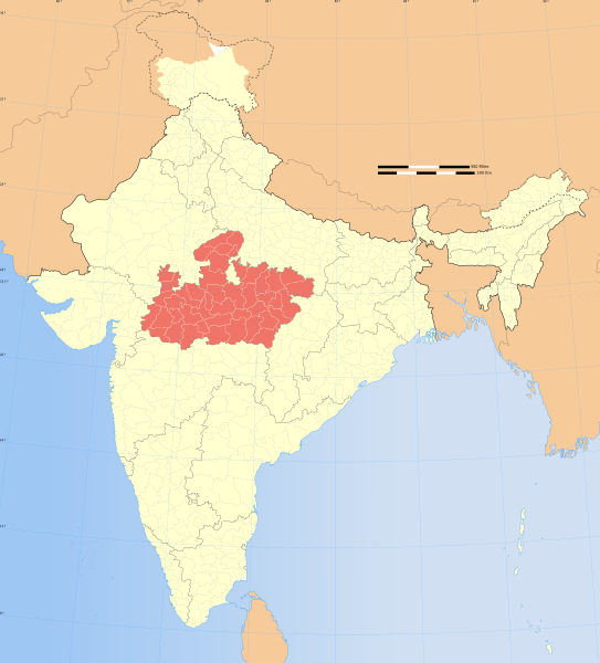
Madhya Pradesh locator map |
|||||||||
| Описание |
English: Locator map of the state of Madhya Pradesh, India with district boundaries.
Français : Carte de localisation du Madhya Pradesh, Inde. |
|||||||||
| Map legend |
 |
|||||||||
| Көнө | ||||||||||
| Сығанаҡ |
Шәхси эш |
|||||||||
| Булдырыусы |
|
|||||||||
| Рөхсәт (Был файлды ҡабатлап ҡулланыу) |
Мин, был хеҙмәткә авторлыҡ хоҡуҡтары эйәһе, үҙ теләгем менән уны түбәндәге лицензия шарттарына ярашлы баҫтырып сығарам: Был файл Creative Commons Attribution-Share Alike 3.0 Unported лицензияһы буйынса рөсхәт ителә.
|
|||||||||
| Geotemporal data | ||||||||||
| Изображённое время | вторая половина XX век и XXI век | |||||||||
| Система пространственной привязки | conic | |||||||||
| Bounding box |
|
|||||||||
| Georeferencing | If inappropriate please set warp_status = skip to hide. | |||||||||
| Archival data | ||||||||||
| Иҫкәрмәләр | Part of WikiProject India Maps | |||||||||
| Башҡа өлгөләр |
|
|||||||||


Notes
Depiction of India's borders
- The territorial boundaries of India are shown as per the actual ground situation in accordance with international practices followed by the United Nations ([1], [2]) and the National Geographic Society ([3], [4])
- This map is meant to be for illustrative purpose only and is not authenticated by official government sources. Please check the list of sources and references used to create the map for a measure of accuracy and verifiability.
- The usage of these maps in India, Pakistan and China are governed by different laws that restrict depictions of boundaries other than what is officially recognized by the state. Please check local laws and modify the map accordingly before use.
Explanation of disputed boundaries


- Boundary of Indian claim : The territory India claims is legally theirs, but the claim is disputed by China and Pakistan.
- Line of Control/Line of Conflict : The de facto administrative boundary recognised by the international community. This UN ceasefire line is considered as a temporary solution to an ongoing conflict since the departure of the British Raj.
Borders of disputed regions
The depicted extent of the former territory of the British Indian Empire, succeeded by Republic of India, may not be accepted by few countries as legal due to ongoing border disputes:
- The northern Himalayan region of the disputed territory Indian-administered Kashmir is claimed by India including (Pakistan-administered Kashmir) and the Chinese-occupied territory of (Ladakh plateau). Since 1972, it is divided between all three countries. See also Line of Control and Line of Actual Control.
- Siachen glacier (shown white) is an actively contested region between India and Pakistan. Since 1984, the region is under Indian control.
- The northeastern territory of Arunachal Pradesh is almost entirely claimed by China as part of its Tibetan territory.
- Minor areas of eastern Kashmir's Ladakh division, Himachal Pradesh and Uttarakhand on the Chinese frontier are claimed by China. These areas are under Indian control.
- A small area of Uttarakhand adjoining the Nepal border along the Sarda river is disputed between the two countries.
For a detailed map of all disputed regions in South Asia, see Image:India disputed areas map.svg
Internal borders
The borders of the state of Meghalaya, Assam and Arunachal Pradesh are shown as interpreted from the North-Eastern Areas (Reorganisation) Act, 1971, but has yet to be verified.
Territorial waters
The limit of the territorial waters of India extends to twelve nautical miles measured from the appropriate baseline. See this for more information.
derivative works
Производные работы от этого файла: India Madhya Pradesh location map.svg
Файл тарихы
Файлдың күрһәтелгән ваҡытта ниндәй өлгөлә булғанын ҡарар өсөн баҫығыҙ: Дата/ваҡыт
| Дата/ваҡыт | Миниатюра | Үлсәмдәре | Ҡатнашыусы | Иҫкәрмә | |
|---|---|---|---|---|---|
| ағымдағы | 06:52, 29 декабрь 2008 | | 1574 × 1738 (836 Кб) | Planemad | {{Information |Description= |Source= |Date= |Author= |Permission= |other_versions= }} |
| 17:38, 6 август 2006 |  | 1639 × 1852 (751 Кб) | Planemad | {{WikiProject_India_Maps |Title=Madhya Pradesh locator map |Description=Locator map of the state of Madhya Pradesh, India with district boundaries. |Source=. |Date=August 6 2006 |Author=w:user:Nichalpw:user:Planemad |Thumbdir=CHANGE } |
Файл ҡулланыу
Был файлды киләһе бит ҡуллана:
Файлды глобаль ҡулланыу
Был файл түбәндәге википроекттарҙа ҡулланыла:
- be-tarask.wikipedia.org проектында ҡулланыу
- be.wikipedia.org проектында ҡулланыу
- bg.wikipedia.org проектында ҡулланыу
- ceb.wikipedia.org проектында ҡулланыу
- da.wikipedia.org проектында ҡулланыу
- en.wikipedia.org проектында ҡулланыу
- Wikipedia:WikiProject India
- User:Ageo020/Userboxes
- Wikipedia:WikiProject Madhya Pradesh
- User:Abhi32
- User:B.arjun
- Template:User interest India
- Template:User interest India/doc
- Template:User WP India
- Template:User WP India/doc
- Category:Madhya Pradeshi Wikipedians
- Wikipedia:Userboxes/Location/India
- Template:User in India
- Template:User in India/doc
- Template:User in Madhya Pradesh
- Template:User in Madhya Pradesh/doc
- Template:User WP Madhya Pradesh
- Template:User WP Madhya Pradesh/doc
- Template:User interest Madhya Pradesh
- Template:User interest Madhya Pradesh/doc
- Template:User citizen India
- Template:User citizen India/doc
- Template:User citizen Madhya Pradesh
- Template:User citizen Madhya Pradesh/doc
- Template:User from India
- Template:User from India/doc
- Template:User from Madhya Pradesh
- Category:Wikipedians interested in Madhya Pradesh
- Category:WikiProject Madhya Pradesh participants
- Template:User from Madhya Pradesh/doc
- Template:User India/doc1
- Template:User Madhya Pradesh/doc1
- User:RKS4444
- User:Navodayarya
- User:Wiki.Gunjan
- Universal basic income in India
- Template:Portal/doc/all
- Template:User lives in
- Template:User lives in/doc
- Wikipedia:Userboxes/Life/Ethnicity/02
- User:Jaywardhan009
- User:Siddharthdhodapkar
- User:Maple leaves1707
- Category:Environment of Madhya Pradesh
- Category:Fauna of Madhya Pradesh
- Category:Flora of Madhya Pradesh
Был файлды глобаль ҡулланыуҙы ҡарарға.